


Voting District 4028, Spokane County, Washington
About
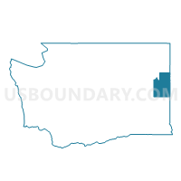
Outline

Summary
| Unique Area Identifier | 689330 |
| Name | Voting District 4028 |
| County | Spokane County |
| State | Washington |
| Area (square miles) | 2.40 |
| Land Area (square miles) | 1.85 |
| Water Area (square miles) | 0.55 |
| % of Land Area | 77.03 |
| % of Water Area | 22.97 |
| Latitude of the Internal Point | 47.64777420 |
| Longtitude of the Internal Point | -117.10344850 |
Maps


Graphs
Select a template below for downloading or customizing gragh for Voting District 4028, Spokane County, Washington


Neighbors
Neighoring Voting District (by Name) Neighboring Voting District on the Map
- Voting District 4026, Spokane County, WA
- Voting District 4027, Spokane County, WA
- Voting District 4029, Spokane County, WA
- Voting District 4301, Spokane County, WA
- Voting District 4302, Spokane County, WA
- Voting District 4303, Spokane County, WA